Tools for the Facility Manager
/Drones are a powerful solution for monitoring construction, capturing hard-to-reach details, and documenting infrastructure on expansive sites.
We are using drone technology, HDS and BIM on our projects to enhance our collaborative relationships for outstanding results. We can measure things that couldn't be measured before, capture images of existing conditions for future reference, bring information to your fingertips as well as create reference points for future site considerations.
The view from above.
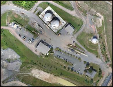
Identifying features on a project site slated for demolition and reconstruction at another location. The imagery from the software is clear at either 20 or 40 scale (1” = 40’).

Measuring design impact.
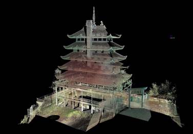
SSM utilized high definition laser scanning equipment and software to quickly and accurately capture the existing structure and landscape conditions for an Amphitheater Design at Swarthmore College. The Revit model and accompanying point cloud allows the team and owner to design and then view the effects their design will have on the multi-terraced levels, stone retaining walls and mature trees.

When access is limited.
The SSM civil and structural engineering team utilized high definition surveying to streamline a project with critical timelines for DeMet’s Candy Company. What started as a simple condition assessment of the exposed steel beams, led to in situ repairs of multiple beams, severely eroded foundations, casting new retaining walls and underpinning. The building literally spans over an active trout stream, which led to access issues for work and equipment. Potential stream impacts required proper documentation and permitting. All of the work was designed and carried out without the aid of heavy machinery. The largest piece of equipment that could gain access to the work area was a small skid loader.

Connect the Dots
Despite the accuracy and speed, the widespread use of high definition scanning (HDS) for documentation of existing buildings has been hindered by the often asked question of “now what do I do with the point cloud?” Many HDS service providers can deliver a point cloud, but have limited experience in developing useful 2D or 3D models of all of the building systems, or the ability to create other useful visual tools for data analysis.
Connecting the dots, or technically speaking, the 3D coordinate data points, was a laborious, time-consuming exercise in the advent of the tool, but thanks to the integration of Point Cloud engines by major players like AutoDesk and Bentley, third-party software is quickly gaining maturity to allow more automated extraction of piping, structure and envelope. If the challenge of what to do with the Point Clouds was a deterrent to utilizing HDS, it’s worth a fresh look at the vastly improved work flows and deliverables.