MARKETS
Expertise
Spatial Analysis
Map Production
Data Conversion
Database Management
3D Visualization
Mobile Applications
Digitizing/Scanning
Data Capture
Metadata Creation
Quality Assurance/Control of Data
Mapping the Coordinates
We utilize GIS to analyze, visualize, and interpret data to understand patterns, relationships, and trends. Through SSM’s extensive geographic data our clients benefit from faster project startups and the economies of readily available data. We don’t just implement GIS for our clients, we use it throughout SSM, every day. We evaluate, design, and implement institutional data to improve decisions and streamline project workflow.
Liberate your GIS data through the use of web-enabled mobile applications.
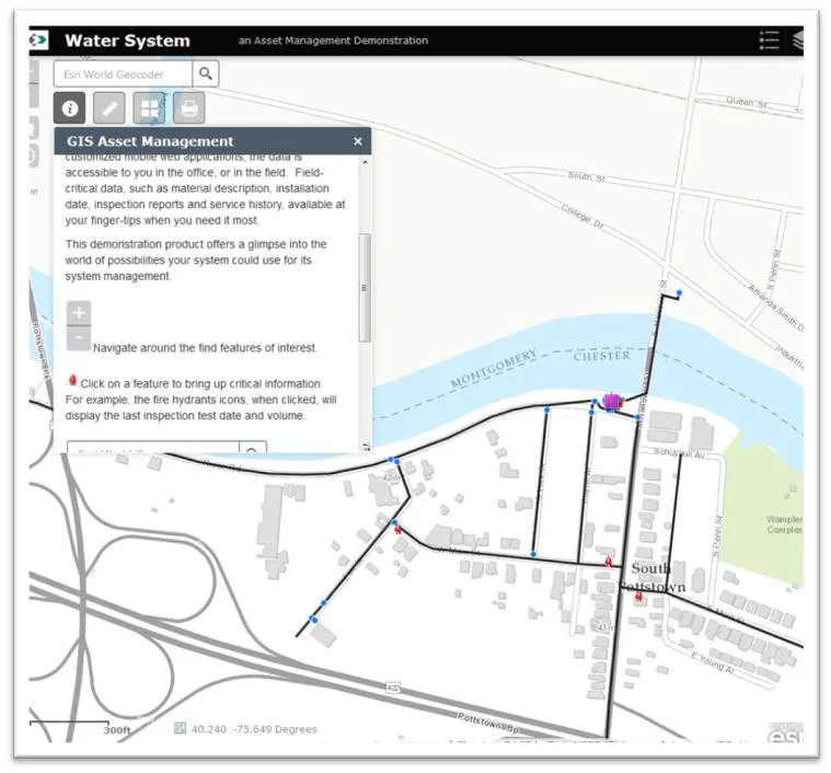
Transform your water/wastewater infrastructure data into an easy-to-use operations asset management system.
SSM’s GIS Asset Management approach captures vital infrastructure data points with your system with survey-grade accuracy. The data is verified and compiled into a geo-spatial database. By creating customized mobile web applications, the data is accessible to you in the office, or in the field. Field-critical data, such as material description, installation date, inspection reports and service history, available at your finger-tips when you need it most.
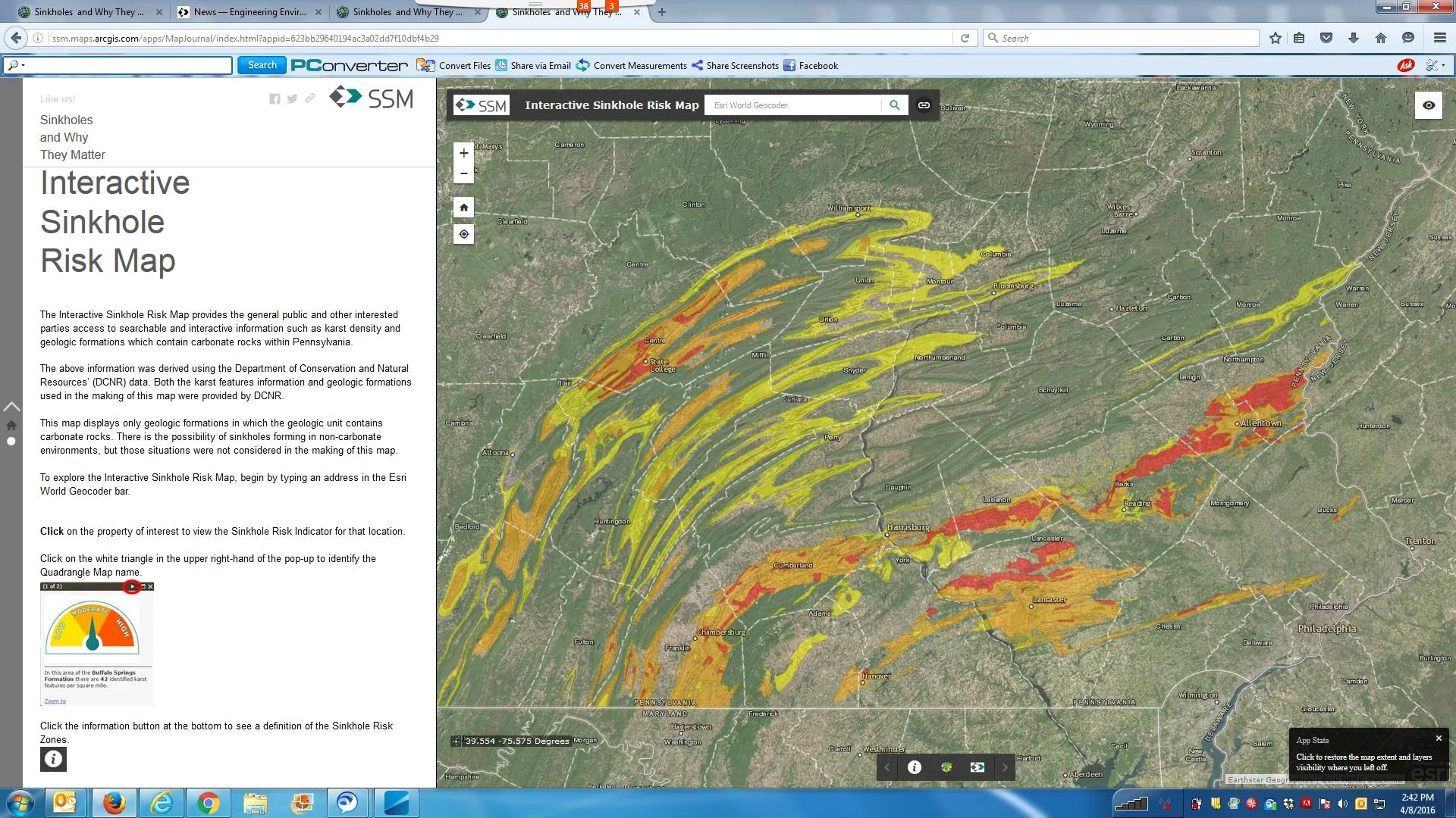
Using GIS to identify sinkhole risk
Using the density of karst features within a geologic formation to identify sinkhole risk.
The Interactive Sinkhole Risk Map provides access to searchable and interactive information such as karst density and geologic formations which contain carbonate rocks within Pennsylvania.
The map displays only geologic formations in which the geologic unit contains carbonate rocks. There is the possibility of sinkholes forming in non-carbonate environments, but those situations were not considered in the making of this map.


Parallel and Coordinated Multi-Municipal Comprehensive Plans that encourage quality development to enhance community image.